GIS & Mapping
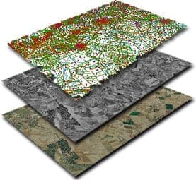
Geo-solutions built on satellite imagery, remote sensing, and bespoke GIS analysis.
Make a Service RequestWe provide geo-solution services as one of our core products, with up-to-date access to satellite imagery, remote sensing images, and other GIS tools.
We offer bespoke solutions and interfaces for clients, including environmental impact assessment, feasibility studies, and spatial inquiries and analysis.
GIS and mapping services
- Asset tracking and management.
- Feasibility and location studies.
- Environmental impact assessment and environmental monitoring.
- Spatial databases and maps built around how your team works.
In Lagos, we have supported GIS monitoring and environmental research on the Lagos Lagoon for Ocean Cleanup International.
Common questions
What is GIS? A geographic information system brings maps, satellite images and other location data together so they can be analysed: where assets are, what is near what, and how an area changes over time.
Can GIS use your survey and drone data? Yes. Our land, hydrographic and drone surveys can feed straight into GIS work alongside satellite imagery.